Mars has been photographed countless times over the years, but some images stand out above all the rest. Among them is an astonishing panorama created by NASA that remains one of the most detailed views ever captured of the Red Planet.
The image offers an unprecedented look at the Martian landscape, allowing scientists and space enthusiasts alike to explore the planet’s surface in remarkable detail.
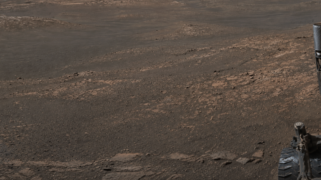
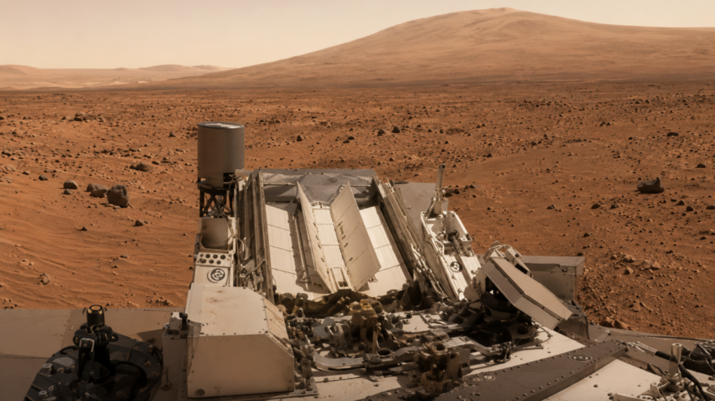
The massive panorama was captured by NASA’s rover, Curiosity, during a mission in 2019. Rather than taking a single photograph, the rover spent six and a half hours over four separate days capturing more than 1,000 individual images.
To ensure that every frame had consistent lighting, the photographs were only taken during a narrow window between noon and 2 p.m. on Mars. After the images were transmitted back to Earth, scientists spent months carefully stitching them together into a seamless 360 degree panorama containing an incredible 1.8 billion pixels.
The resulting image showcases the stunning Glen Torridon region, located on the lower slopes of Mount Sharp. Today, the area appears dry and rocky, but billions of years ago it was a very different environment. Scientists believe the region once contained lakes, streams, and other bodies of water that may have persisted for long periods.
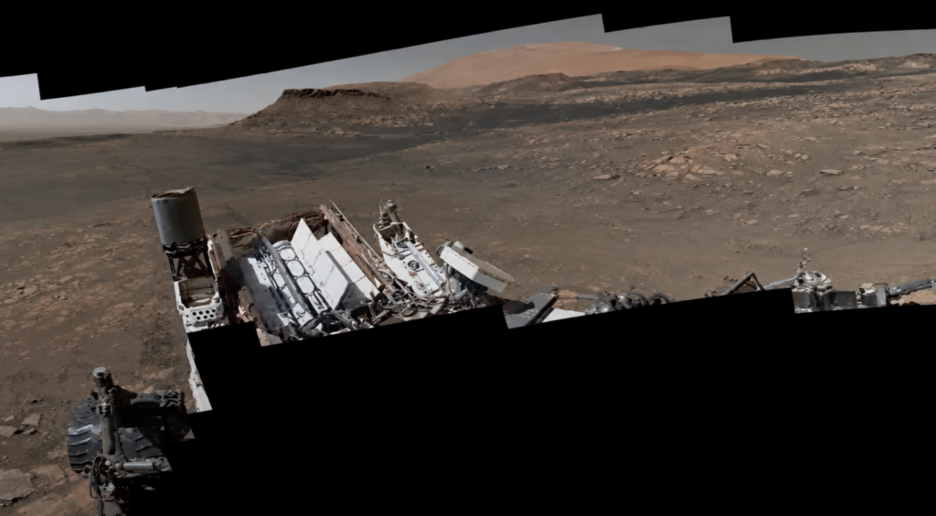
Evidence of this watery past can still be seen in the layers of clay rich rock scattered across the landscape.
The panorama also reveals several notable landmarks. Among them is the Slangpos crater, a feature measuring approximately 4.8 kilometers (3 miles) across. The image also captures the steep cliffs and rugged terrain of the Central Butte, providing researchers with valuable information about the geological history of the region.
Every section of the panorama contains details that help scientists better understand how Mars evolved over billions of years.
This was not the first time Curiosity created a record breaking Martian panorama. In 2013, the rover assembled another high resolution image featuring the Rocknest sand patch near the base of Mount Sharp. That earlier panorama consisted of roughly 900 photographs and contained about 1.3 billion pixels, making it one of the most detailed images of Mars at the time.
The continued success of Curiosity demonstrates how robotic explorers are transforming our understanding of the solar system.
Each new image reveals fresh details about Mars’ ancient environment, helping scientists investigate whether the planet may once have been capable of supporting microbial life.
As Curiosity continues its journey across the Martian surface, even more breathtaking photographs are expected to follow.
Whether those images eventually reveal evidence of past life remains one of the biggest questions in planetary science, but each new panorama brings researchers one step closer to finding the answer.